MegaSceneryEarth Colorado Complete State Photoreal Scenery for FSX/P3D

This might just be the most visually spectacular state of all. Fly the entire state - BORDER to BORDER - of Colorado in photoreal detail. Colorado is over 104,093 square miles in size and has 272 airports. You'll see everything that you see in Colorado in real life in the scenery. Read more...
- Media Format
- Immediate Download
- Compatibility
- Microsoft Flight Simulator X and Prepar3D
- File size
- 37.3 GB
- Developer
- PC Aviator
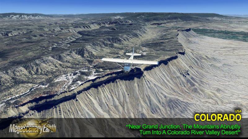
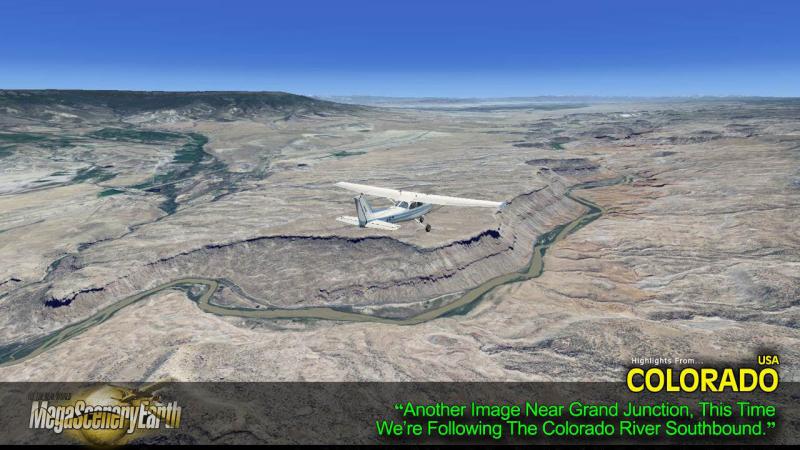
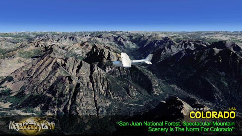
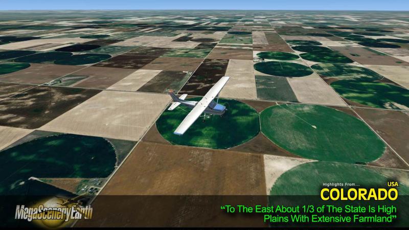
Colorado is a visually spectacular and fun place to fly with Rocky Mountain terrain with towering mountain peaks above 14,000 feet. Average elevation of Colorado is 6,800 feet, higher than any other state. This kind of terrain is where MegaSceneryEarth 2.0's high res graphics really shine. You'll be truly stunned by the scenery of Colorado.
Imagery is clear and crisp 50 cm source throughout for a stunningly realistic scenery.
As an added bonus, we now provide all the VFR and IFR charts in digital PDF format to enable you to get the most out of your scenery. This includes 3 Sectionals, 2 Terminal Area Charts, 5 IFR enroute charts, and a 477 page book of Instrument Approach plates, Airport Diagrams, SIDs and STARs, and an Airport Facility Directory. The charts are downloadable along with your scenery files.
Some of the cities and landmarks you'll get to enjoy as you explore Colorado include:
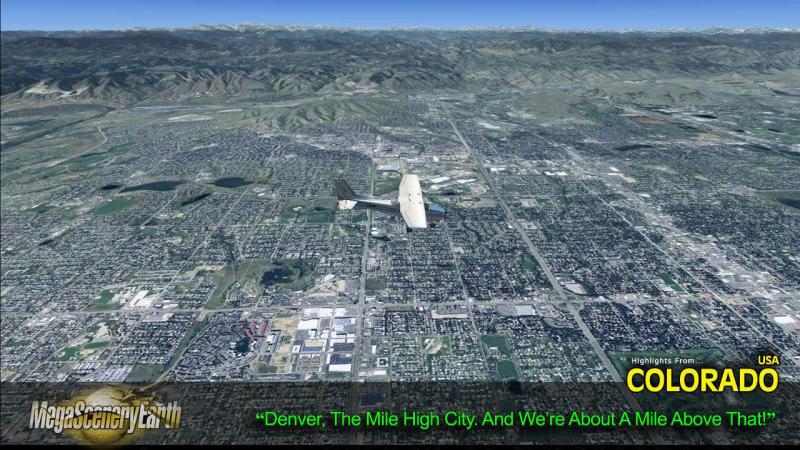
Cities: Denver, Colorado Springs, Aurora, Lakewood, Fort Collins, Arvada, Boulder
Lakes & Water Bodies: Grand Lake, Blue Mesa Reservoir, John Martin Reservoir
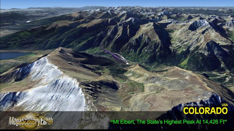
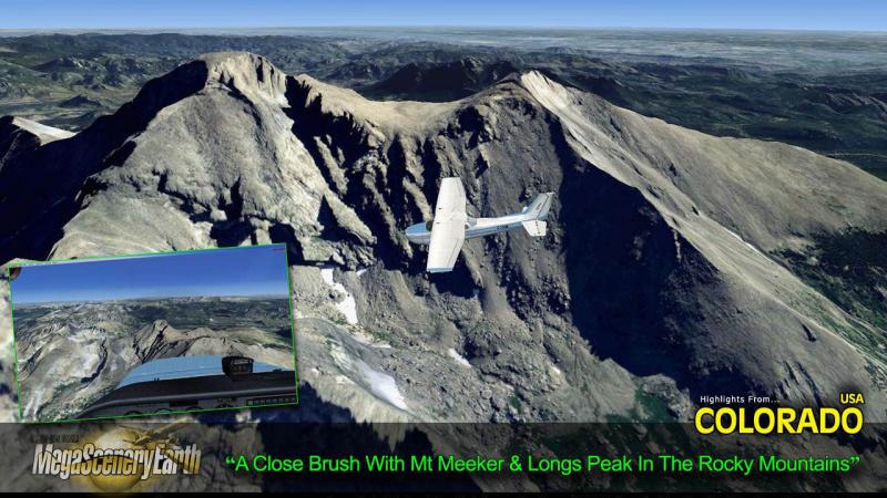
Mountains & Hills: Mount Elbert (14,426 ft), Mount Harvard, Mount Massive, La Plata Peak, Blanca Peak and a total of 50 other peaks and mountains above 14,000 feet. Mean state elevation 6,800 ft.
State Parks & National Forests: Arapaho National Forest, Comanche National Grassland, Grand Mesa National Forest, Gunnison National Forest, Pawnee National Grassland, Pike National Forest, Rio Grande National Forest, Roosevelt National Forest, Routt National Forest, San Isabel National Forest, San Juan National Forest, Uncompahgre National Forest, White River National Forest
Major Rivers: Colorado River, Rio Grande, Arkansas River, South Platte River
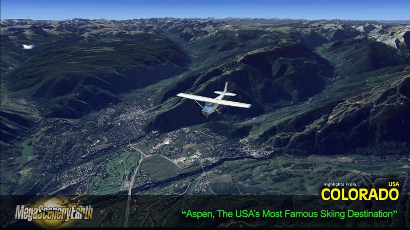
Other Highlights: Aspen
Discover the rest of it all for yourself! There's a LOT to see!
THIS TITLE COMES WITH A FULL SET OF FAA AERONAUTICAL CHARTS FOR Colorado IN PDF FORMAT.
Here's what you get (download links for charts will be given to you with your product download):
SECTIONAL CHARTS: Cheyenne, Denver, Wichita
TERMINAL AREA CHART: Denver, Colorado Springs
LOW ALTITUDE IFR CHARTS: ELUS-07/ELUS-08, ELUS-09/ELUS-10, ELUS-15/ELUS-16
HIGH ALTITUDE IFR CHARTS: EHUS-03/EHUS-04, EHUS-05/EHUS-06
AIRPORT FACILITY DIRECTORY: A FULLY INDEXED 46 PAGE PDF BOOKLET
APPROACH CHARTS & AIRPORT DIAGRAMS: A FULLY INDEXED 477 PAGE PDF BOOKLET

Related Products


Submit a review of this product
Do you own a copy of this add-on? Have you used it? We'd love to hear your feedback on it below. You don't even need to have purchased it from SimShack.