MegaSceneryEarth Idaho Complete State Photoreal Scenery for FSX/P3D

Another mountain state, pure visual spectacle, fly the entire state - BORDER to BORDER - of Idaho in photoreal detail. Idaho is over 83,570 square miles in size and has 219 airports. You'll see everything that you see in Idaho in real life in the scenery. Read more...
- Media Format
- Immediate Download
- Compatibility
- Microsoft Flight Simulator X and Prepar3D
- File size
- 35.2 GB
- Developer
- PC Aviator
Idaho is yet another of the visually spectacular mountain states featuring the Northern Rocky Mountains.
Imagery is clear and crisp 50 cm source throughout for a stunningly realistic scenery.
As an added bonus, we now provide all the VFR and IFR charts in digital PDF format to enable you to get the most out of your scenery. This includes 2 Sectionals, 3 IFR enroute charts, and a 161 page book of Instrument Approach plates, Airport Diagrams, SIDs and STARs, and an Airport Facility Directory. The charts are downloadable along with your scenery files.
Some of the cities and landmarks you'll get to enjoy as you explore Idaho include:
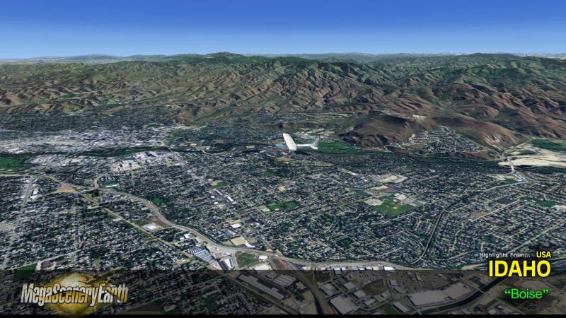
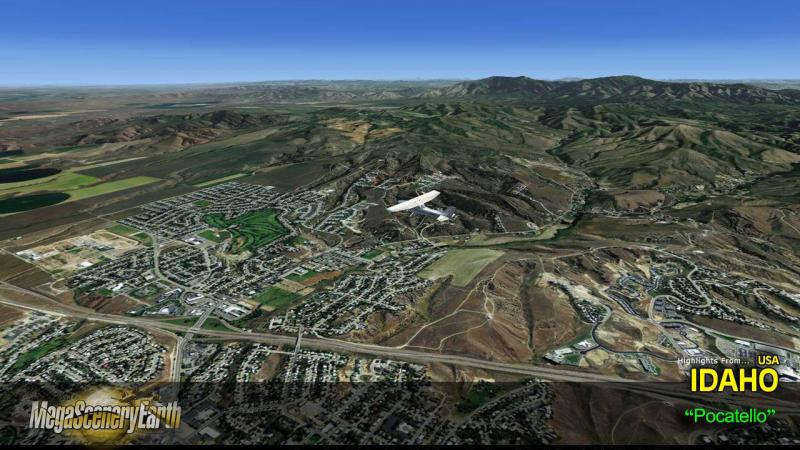
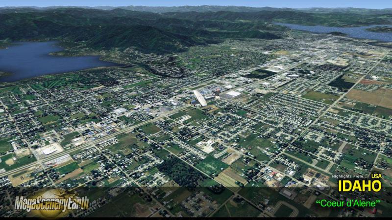
Cities: Boise, Nampa, Pocatello, Idaho Falls, Meridian, Coeur D Alene, Twin Falls
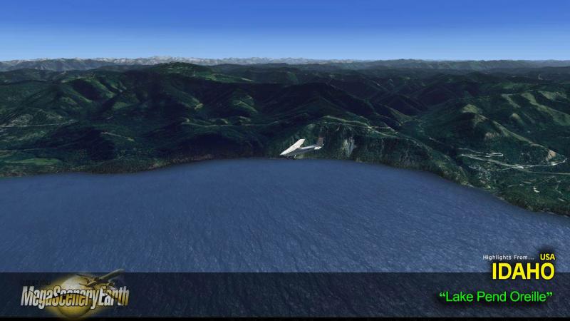
Lakes & Water Bodies: Lake Pend Oreille, American Falls Reservoir, Bear Lake, Coeur d'Alene Lake
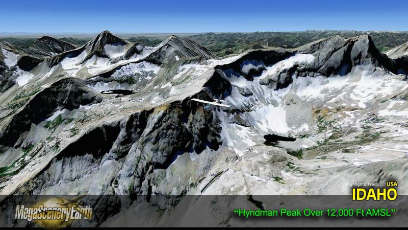
Mountains & Hills: Borah peak (12,510 ft), Leatherman Peak, Pioneer Mountains, Hyndman Peak, Diamond Peak, Standhope Peak and a total of 50 other peaks and mountains above 11,000 feet.
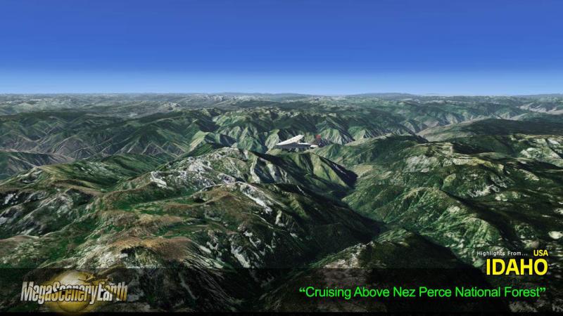
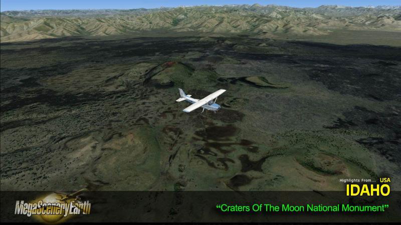
State Parks & National Forests: Boise National Forest, Caribou-Targhee National Forest, Clearwater National Forest, Curlew National Grassland, Idaho Panhandle National Forests: Coeur d'Alene, Kaniksu, and St. Joe National Forests, Nez Perce National Forest, Payette National Forest, Salmon-Challis National Forest, Sawtooth National Forest
Major Rivers: Coeur d'Alene River, Snake River, St. Joe River, St. Maries River, Kootenai River
Discover the rest of it all for yourself! There's a LOT to see!
THIS TITLE COMES WITH A FULL SET OF FAA AERONAUTICAL CHARTS FOR Idaho IN PDF FORMAT.
Here's what you get (download links for charts will be given to you with your product download):
SECTIONAL CHARTS: Great Falls, Salt Lake City
LOW ALTITUDE IFR CHARTS: ELUS-11/ELUS-12, ELUS-13/ELUS-14,
HIGH ALTITUDE IFR CHARTS: EHUS-01/EHUS-02
AIRPORT FACILITY DIRECTORY: A FULLY INDEXED 41 PAGE PDF BOOKLET
APPROACH CHARTS & AIRPORT DIAGRAMS: A FULLY INDEXED 161 PAGE PDF BOOKLET

Related Products


Submit a review of this product
Do you own a copy of this add-on? Have you used it? We'd love to hear your feedback on it below. You don't even need to have purchased it from SimShack.