MegaSceneryEarth Georgia Complete State Photoreal Scenery for FSX/P3D

Fly the entire state - BORDER to BORDER - of Georgia in photoreal detail. Georgia is a massive 59,425 square miles in size and has 349 airports. You'll see everything that you see in Georgia in real life in the scenery. Read more...
- Media Format
- Immediate Download
- Compatibility
- Microsoft Flight Simulator X and Prepar3D
- File size
- 24.42 GB
- Developer
- PC Aviator
Recreated with 50 cm aerial photography throughout.
As an added bonus, we now provide all the VFR and IFR charts in digital PDF format to enable you to get the most out of your scenery. This includes TACs and Sectionals, IFR enroute charts and 650 page book of Instrument Approach plates, Airport Diagrams, SIDs and STARs. The charts are downloadable along with your scenery files.
Some of the cities and landmarks you'll get to enjoy as you explore Georgia include:
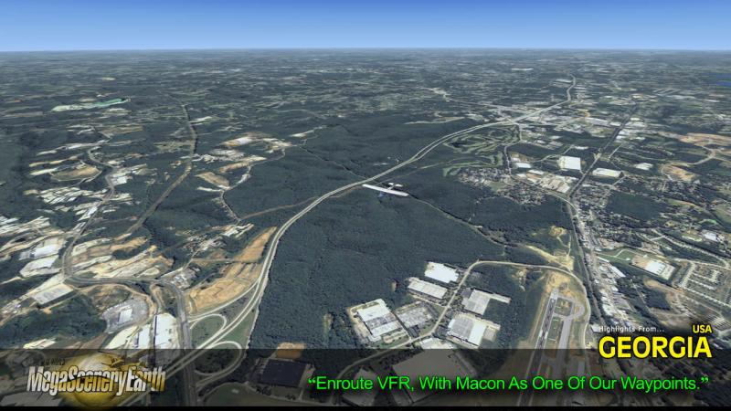
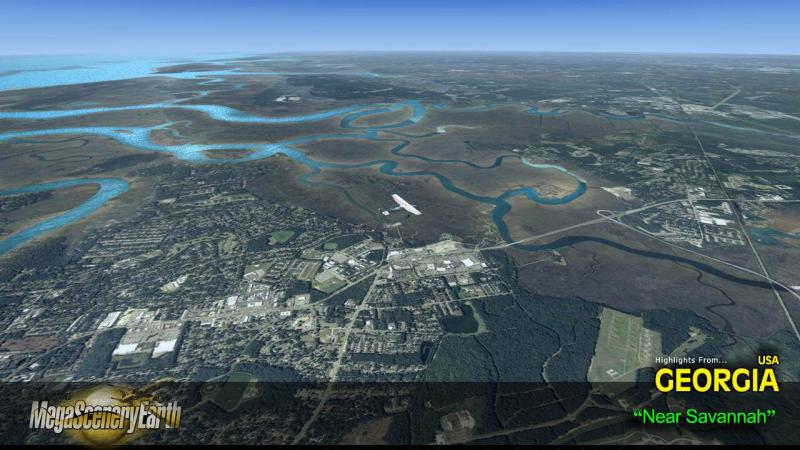
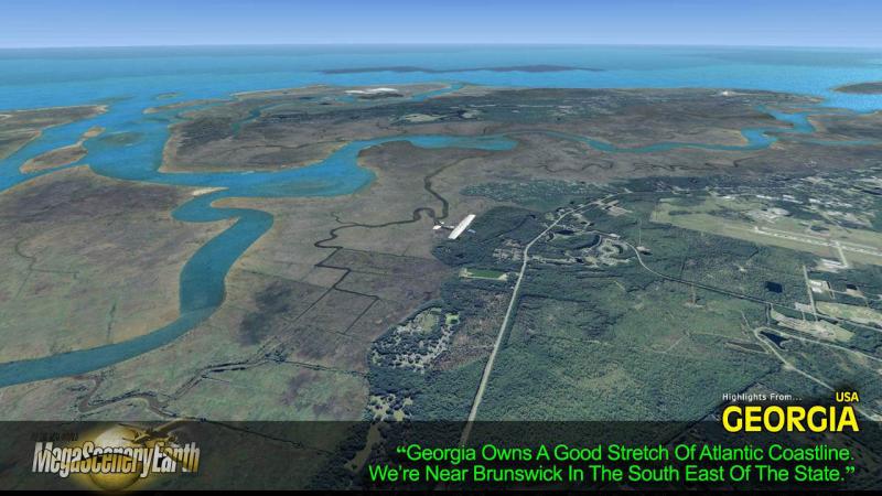
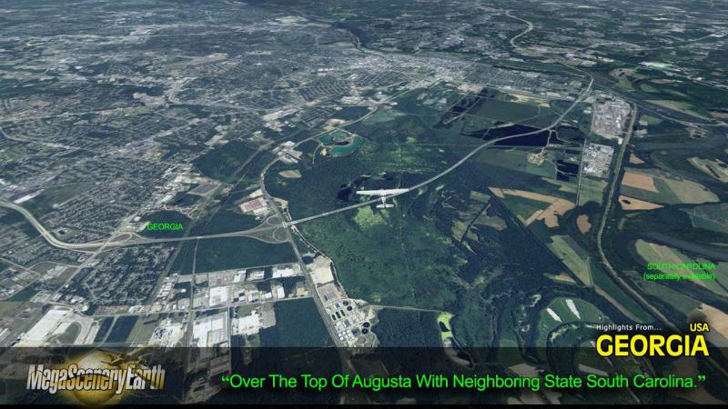
Cities: Atlanta, Augusta, Columbus, Savannah, Athens, Macon, Marietta
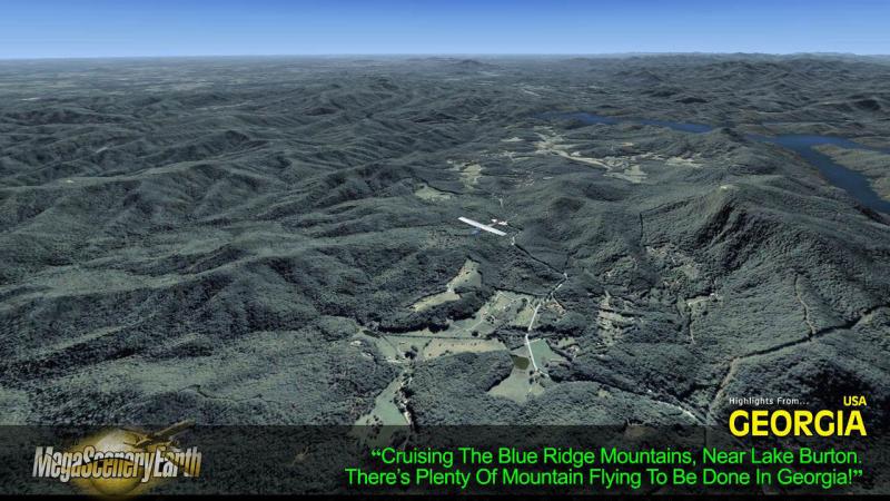
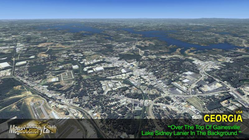
Lakes: Lake Lanier, West Point Lake, Lake Seminole, Lake Oconee, Lake Sinclair, Blue Ridge Lake
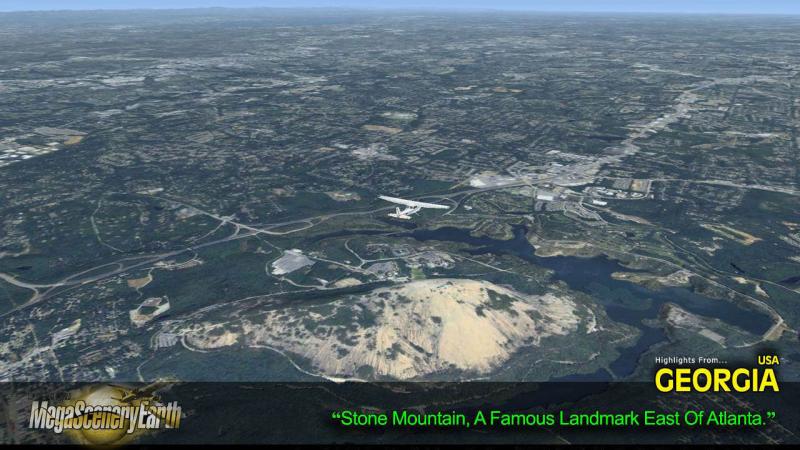
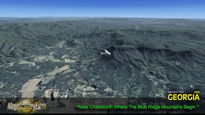
Mountains & Hills: Blue Ridge Mountains, Rabun Bald (4,695 ft), Dicks Knob, Blood Mountain, Tray Mountain, Slaughter Mountain, Chimney Top and 50 other peaks above 3800 ft.
State & National Parks & Forests: Chattahoochee-Oconee & Cohutta National Forests and numerous state parks and beautiful Blue Ridge mountain area,
Major Rivers: Savannah, Oconee, Flint, Satilla, Etowah, Ocmulgee
Some Other Major Highlights:
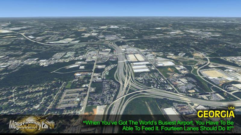
Georgia hosts the world's busiest airport - Atlanta International (KATL) with over 92,000,000 passengers per year and 3,000 aircraft movements per day.
Beautiful Savannah - Georgia's most famous historic and tourist town
Blue Ridge Mountains and shared border with North Carolina's and Tennessee's mountains.
THIS TITLE COMES WITH A FULL SET OF FAA AERONAUTICAL CHARTS FOR Georgia IN PDF FORMAT.
Here's what you get (download links for charts will be given to you with your product download):
SECTIONAL CHARTS: Atlanta, Charlotte, Jacksonville
TERMINAL AREA CHARTS: Atlanta
LOW ALTITUDE IFR CHARTS: ELUS-17/ELUS-18, ELUS-21/ELUS-22 and ELUS-23/ELUS-24
HIGH ALTITUDE IFR CHARTS: EHUS-9/EHUS-10
APPROACH CHARTS & AIRPORT DIAGRAMS: A 650 PAGE PDF BOOKLET

Related Products


Submit a review of this product
Do you own a copy of this add-on? Have you used it? We'd love to hear your feedback on it below. You don't even need to have purchased it from SimShack.
Customers Also Purchased


